|
|
The Ipcress File
locations
( + Google Earth coordinates
)
|
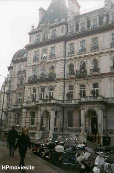 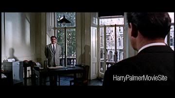
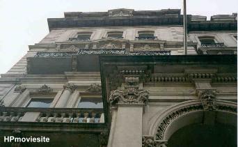
| The most important filmlocation
of the Ipcress File was 28 and 30 Grosvenor Gardens, London (see
topright photo). Here Dalby's Office (his "employment bureau")
was situated here. The two houses were converted into one huge
house containing 40 rooms. These were enlarged or divided
according to requirements. Fourteen room were used as studios.
Other rooms were turned into dressing rooms, wardrobe department,
hairdressing, make-up, production offices, a property department
and a self-contained restaurant capable of feeding and seating
120 people! This all was kept secret to keep away sight-seers
and autograph hunters. Even Michael Caine was driven to work in
an inconspicuous car and had to sneak in the back way. As a
'front' for the real purpose, a large sign was painted at the
entrance to the film studios. The sign read:" The Dalby
Employment agency".
Google Earth
Latitude: 51°29'50.03"N
Longitude: 0° 8'48.20"W |
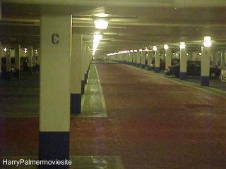 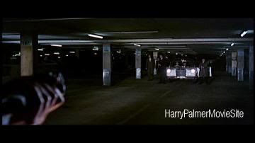
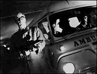
| The famous exchange where
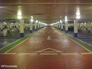
scientist Redcliff is given back for hard cash was filmed in a
carpark under Hyde Park in London. The carpark still exists and
is called the Marble Arch carpark. Nothing much has changed
really except for better lighting and some bright colours. There
are several entrances but the main (car)entrance is at Park Lane.
Google Earth
Latitude: 51°30'33.28"N
Longitude: 0° 9'22.81"W |
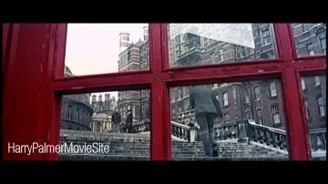 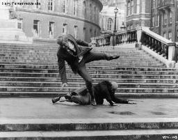
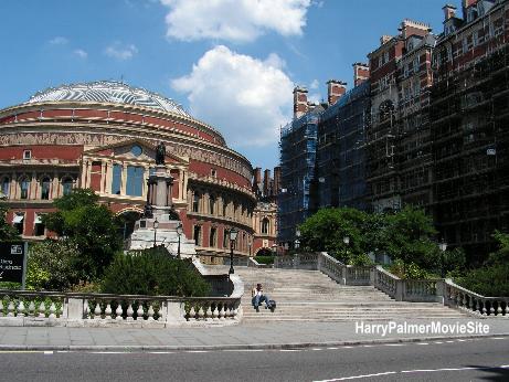
| The fight between "Housemartin"
and Harry Palmer takes place on the stairs of the Royal Albert
Hall. A lot of scenes were filmed around the Hall. The fight
between Palmer and Housemartin was filmed from the Prince
Consort Road. The telephonebooth was placed there especially for
the movie although there is one now on the other side of the
street. Bluejay's car was parked on the road around the Albert
Hall but that road no longer exists.
Google Earth
Latitude: 51°30'0.19"N
Longitude: 0°10'38.03"W |
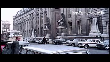
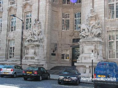
| When Palmer follows
Housemartin for the first time to the Science Museum library,
they both enter this building, the Royal School of Mines, a
department of the Imperial College of Science. You can find it
on the Prince Consort Road SW7, on the other site of the Albert
Court. Google Earth
Latitude: 51°29'59.32"N
Longitude: 0°10'32.59"W |
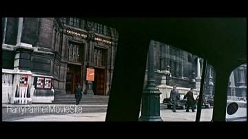
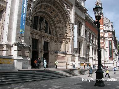
| When Prof.
Radcliffe has returned to his normal life, Palmer serves as a
bodyguard. They both leave this building to get into their car
on their way to the lectureof the Professor. It is the Victoria
and Albert Museum on Cromwell Road in South Kensington.
Google Earth
Latitude:51°29'46.25"N
Longitude:0°10'19.06"W |
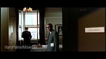
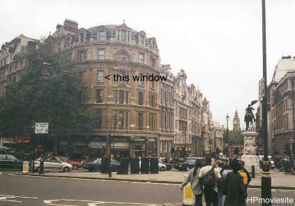
| Ross office looks out over
Trafalgar Square. The building in which the 'Ross' office is
located is found on the south side of Trafalgar Square, London.
In the back you can see the Big Ben. Comparing the scenes in the
film it must have been the third floor office. The same office
was used in Funeral in Berlin and Billion Dollar Brain.
Google Earth
Latitude: 51°30'26.09"N
Longitude: 0° 7'38.22"W |
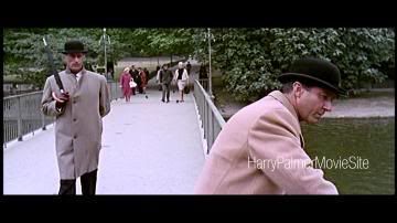
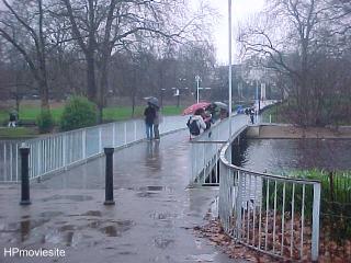
| Dalby and Ross meet in a park to
discuss matters and whether to pick up Grantby or not. This was
filmed in St.James's Park They enter the park from The Mall and
walk towards a bridge. You'll recognize the bridge over the
St.James's Park Lake. After that scene they walk towards the
Birdcage Walk. Google Earth
Latitude:51°30'8.30"N
Longitude: 0° 8'7.04"W |
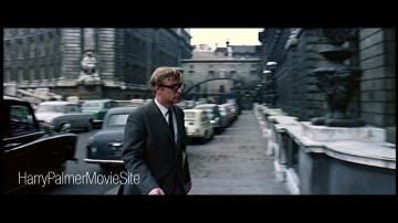
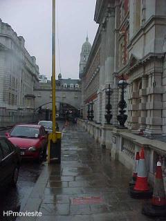 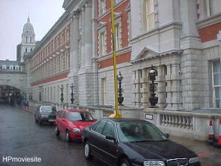
| After "Old Muggins" has come to
take over surveillance duties from Harry, our secret agent has
to come to headquarters. He enters the building in a little
sidestreet of The Mall, just behind Trafalgar Square. It is the
Old Admiralty Building.
Google Earth
Latitude: 51°30'22.25"N
Longitude: 0° 7'44.54"W |
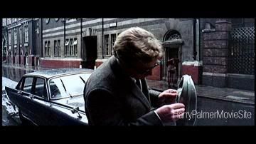
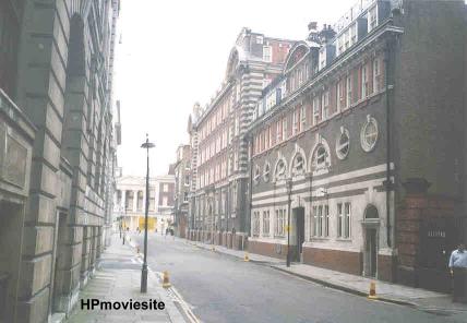
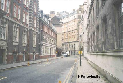
| When Harry gets his first
assignment from Dalby, he drives to his friend Pat who works at
Scotland Yard (here he checks Grantby's parking tickets). You
can find this building in a street which is called Great
Scotland Yard, it is near Trafalgar Square. Harry parks his car
opposite the building you see in the top picture. I was told
this building is still used by Scotland Yard.
Google Earth
Latitude: 51°30'22.96"N
Longitude: 0° 7'32.23"W |
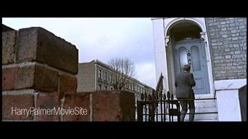
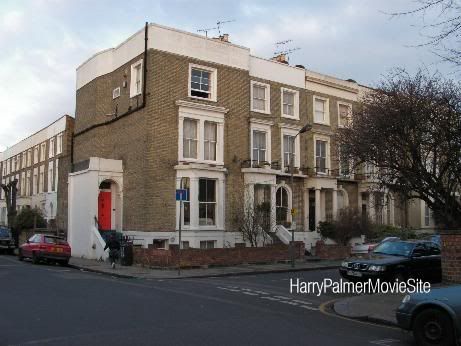
| Harry Palmer's house is situated
in Sheperd's Bush in London, 9 Stanlake Villas. The blue door
changed into red. I found this Ipcress File location on the very
good site
http://www.reelstreets.com
by John and Brian Tunstill. The house and neighbourhood can be
found behind the rear of Shepherd's Bush police station,
Stanlake Villas junction with Stanlake Rd London W12. More
photos of this location can be found here:
http://www.reelstreets.com/2005/09/ipcress-file.html
Google Earth
Latitude: 51°30'23.96"N
Longitude: 0°13'41.45"W |
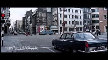
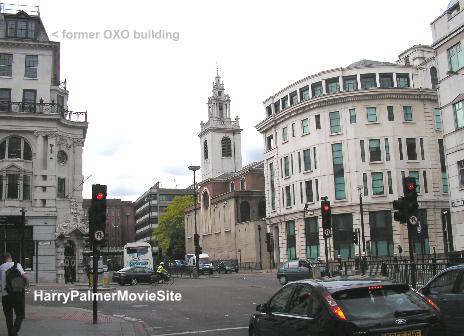
| The location in London where
Carswell is shot in his car was found by Keith: Upper Thames
Street at the junction with Queen Street Place. I only added
pictures. This was what Keith left on the messageboard:
"Been irritated for years that I
couldn't identify the location used for the scene where Carswell
is shot in the blue Ford Zephyr. Penny finally dropped. It is
Upper Thames Street E.C.4 @ the junction with Queen Street
Place, left of the lights, & Queen Street to the right of the
traffic lights. The car is travelling west towards what is now
Blackfriars underpass. The give away features are the church he
drives past, laying back from the road (I believe it is a
Christopher Wren church), & the building to the immediate right
of the church as you view the scene. The bridge he passes under
is called Cannon Bridge & there is an office block built on top
these days. This leads to Cannon Street railway station.All the
other buildings near the church are gone.
The building to the left of the lights (Queen Street Place) was
used by the OXO company in 1965 - the second 'O' is obscured by
the traffic light post, no product placement allowed in 1965 eh?
The building is still there however. To the right of the lights
(Queen Street) the buildings have been swept away & rebuilt. It
is now closed to traffic & a barrier prevents access.
Ahead is the continuation of Upper Thames Street. It has since
been widened so that the road as it was then is now the
westbound half of a dual carriage way. The buildings on the
right behind the "Drinka Pinta Milka Day" poster have been
demolished & the eastbound half of the dual carriage way created
in their place.
So now we know." Keith
Google Earth
Latitude: 51°30'38.93"N
Longitude: 0° 5'34.76"W |
 new
new
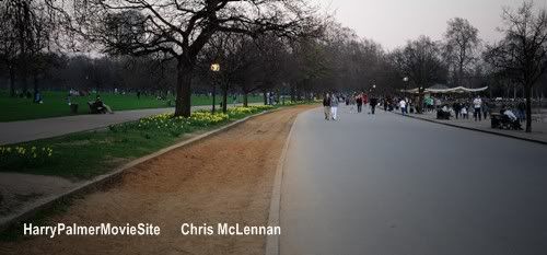
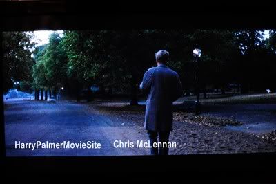
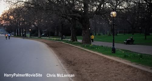
Image courtesy of Kurt Meyer:
 new
new
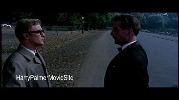
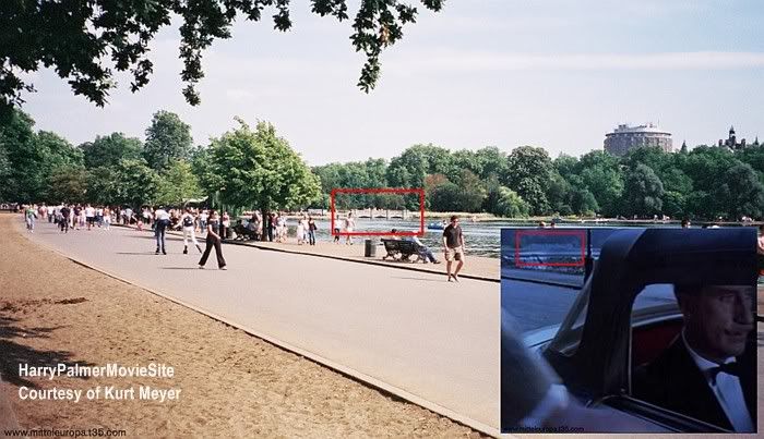
| Completely
revised 'T 108', the place where Dalby
and Palmer meet, after Harry has found a dead American agent
in his flat, was filmed north of the
Serpentine Lake in Hyde Park, London. Thanks to Kurt Meyer and
Chris McLennan I was able to find the exact location. Extra
photos by Chris and Kurt. For very detailed location info,
check Kurt's site:
mitteleuropa.t35.com
Info by Kurt Meyer:
If you stand with your back to
the shore of the lake and looking up the slope of the hill as
the ground rises away from you, you will see a large stand of
trees and undergrowth, which should be position to your left.
Coming down the slope toward you is a pathway. The pathway
moves across your front to your right as it moves toward the
lake. When it nears the road upon which you are standing,
people walk off the pathway across the grass to the road,
leaving a pathway worn into the grass. This is just visible
behind the actors in one of the frames. The park bench T108
was just to the right of this pathway and is now to the left.
(west).
Google Earth
Latitude:
51°30'21.78"N
Longitude: 0° 9'48.29"W |
 new
new
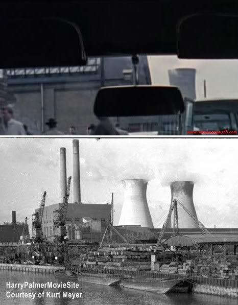
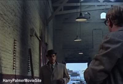
| The warehouse where
the secret service raids a possible location of the scientist's
kidnappers/brainwashers under the command of Harry ('CC3') was
found by Kurt Meyer. Very difficult to find, but he did it again!
It is near Bidder Street in London, in the old East India area.
new
Info by Kurt Meyer:
This location is at West Ham B
power station, which was built on the site of the old East India
Dock after World War II. It was in operation until a few years
before The Ipcress File was filmed and remained
standing until the late Eighties. The power station and its
associated buildings were demolished along with nearly all of
the old buildings in the area. Some of the original site layouts
remain around the switching house, which still operates as a
power distribution center. The entire area was remodelled, the
railway line removed and most of the road layout changed.
For very detailed location
info, check Kurt's site:
mitteleuropa.t35.com
Google Earth
Latitude:
51° 31′ 4.8″ N
Longitude:
0° 0′ 5.04″ E |
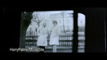
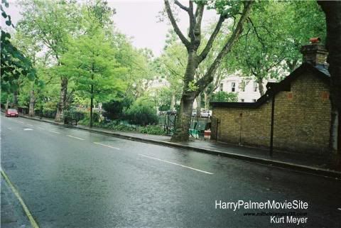
| Kurt Meyer from Germany found
the location where the black and white film was filmed, the 'instruction
film' that is shown to all secret agents at the meeting with Dalby. Located in Little Venice, Blomfield Road,
London. Thanks Kurt Meyer (
mitteleuropa.t35.com). Google Earth
Latitude:
51°31'20.49"N
Longitude: 0°10'52.81"W |
Back
|
|


 new
new


 new
new new
new

